Point Cloud Registration & Clean-up
Importing and processing diverse point cloud formats, setting exact origin points, and cleaning noise and reflections.

Scan-to-BIM & Retrofit Modeling
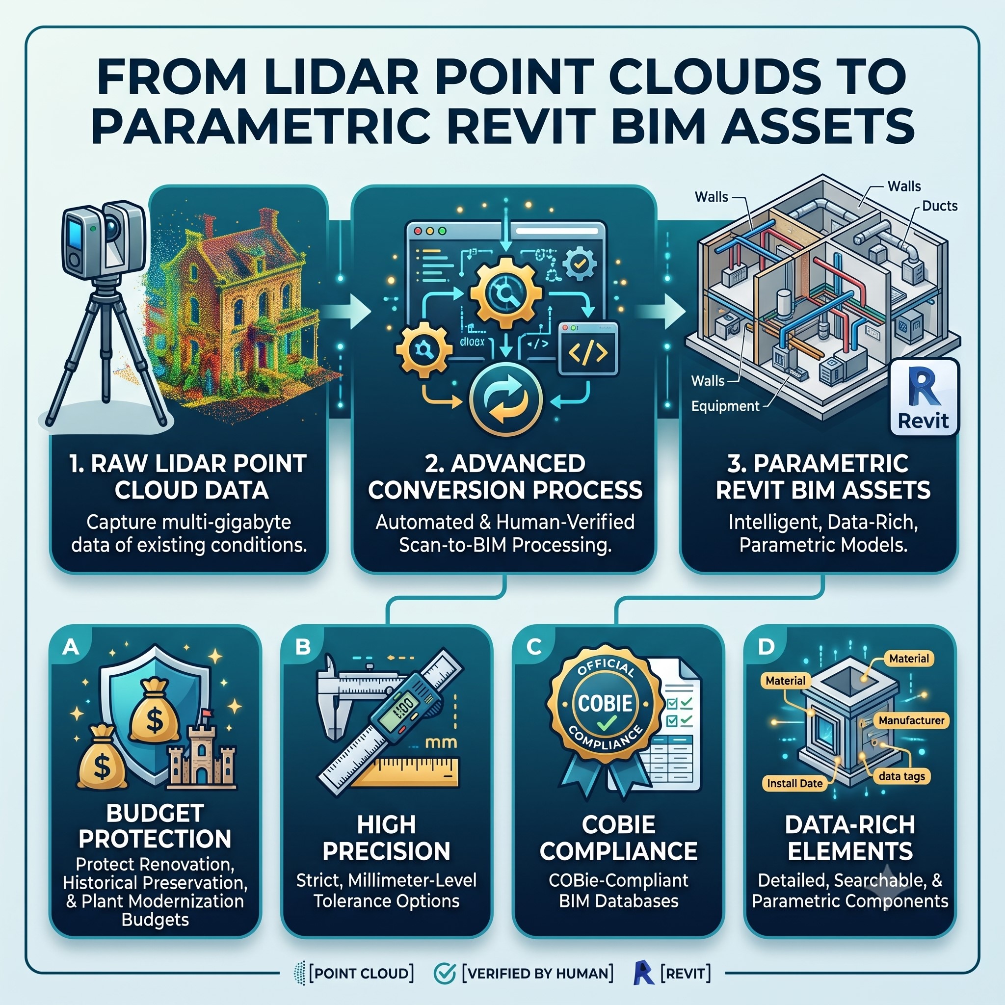
Protect your renovation, historical preservation, and plant modernization budgets. We convert multi-gigabyte point clouds into highly detailed, parametric, and COBie-compliant BIM databases with strict, millimeter-level tolerance options.
Overview
From point-cloud registration through as-built structural and MEPF retrofit modeling, we deliver COBie-compliant parametric Revit assets with documented deviation audits.
Core technical capabilities
Importing and processing diverse point cloud formats, setting exact origin points, and cleaning noise and reflections.
Modeling real-world architectural and structural concrete, structural steel frameworks, and structural column geometries directly from point-cloud datasets.
Modeling complex MEPF distribution networks, chemical processing pipes, and industrial utility corridors from scanned arrays.
Mapping and recording actual physical structural sags, out-of-plumb concrete columns, and beam deflections to ensure virtual coordinates match physical conditions.
Specifications
| Specification Parameter | Standard Alignment |
|---|---|
| Supported File Formats | .e57, .rcp, .rcs, .las, .pts point formats |
| Modeling Applications | Autodesk Revit, Leica Cloudworx, ClearEdge3D EdgeWise |
| Accuracy Tolerances | Level 1 (millimeter precision) to Level 3 (standard construction specs) |
| Asset Databases | COBie-compliant sheets, dynamic Revit parameter sets |
Deliverables
Tech stack expertise
Our team is highly skilled in utilizing industry-leading digital tools. We select the optimal technology for each project to ensure both agile performance and cost-efficiency.














Client onboarding journey
You upload registered point cloud datasets directly to our secure FTP/cloud portal.
We define and confirm structural modeling tolerances and required LOD targets (e.g., LOD 300 vs. LOD 350).
We build custom, smart families matching physical equipment dimensions.
We perform deviation audits to ensure model parameters align perfectly with the raw point cloud.
FAQs
.e57, .rcp, .rcs, .las, and .pts.
Level 1 (millimeter precision) through Level 3 (standard construction specs), confirmed before modeling.
Yes — COBie-compliant sheets with dynamic Revit parameter sets are part of the Scan-to-BIM package.
Book a 30-minute technical consultation to map your BEP, CDE, and delivery gates with our engineering team.